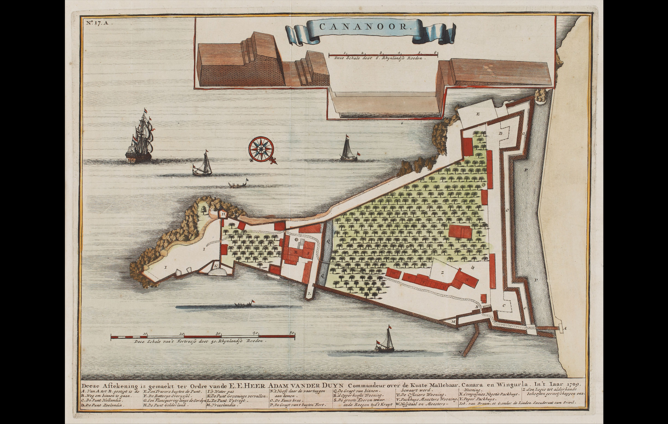
This is a ground plan of the Kannur Fort in Kerala. The map is attributed to François Valentijn (1666-1727), a Dutch Minister and employee of the VOC (Dutch East India Company).
Don Francesco de Almedia, the first Portuguese Viceroy of India, constructed the Kannur Fort, also known as St. Angelo’s Fort, in 1505. For more than a century and a half, it was a key component of the Portuguese empire’s colonial development. In 1662–1663, the Dutch took control of it, and by the late 18th century, the British had taken it and turned it into an important military outpost in South India.
The inscription at the bottom is in Dutch and reads, ‘This signature was made on the order of the E.E.Heer Adam Vander Duyn Commander over the coast of Malabar, Canara and Vengurla in the year 1700.’
Title
Cananoor (Plan of the Cannanore, Kannur Fort)Period
1724Cartographer
Francois ValentynDimensions
H: 33.5 cm x W: 41.6 cm (approx)Accession No.
(2017.14.3)Genre: Cartography