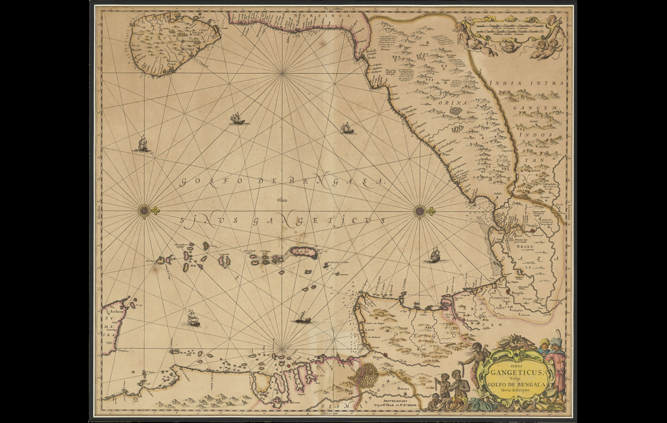
This map, made by Johannes Janssonius (1588-1664), a Dutch cartographer, illustrates the Bay of Bengal in detail and is one of the oldest sea maps. While it may appear disorienting, the inclusion of ‘Orixa’ and ‘Ceylon’ aid in establishing orientation, with Ceylon to the left of the map representing the south.
The Dutch East India Company (Vereenigde Oost Indische Compagnie, VOC) had established itself in India as a trading company since the 17th century. With their commercial interests in the subcontinent, they had set up trading posts along the Malabar and Coromandel coast of India. They indulged in trading silk, cotton, textiles, indigo, etc.
To read more on early maps, click here.
Title
Sinus Gangeticus Vulgo Golfo De Bengala Nova defcriptio (Gulf of Ganges, Gulf of Bengal, New Description)Period
c.1657Cartographer
Johannes JanssoniusDimensions
H: 46cm x W: 54cmAccession No.
2021.12.11Genre: Cartography