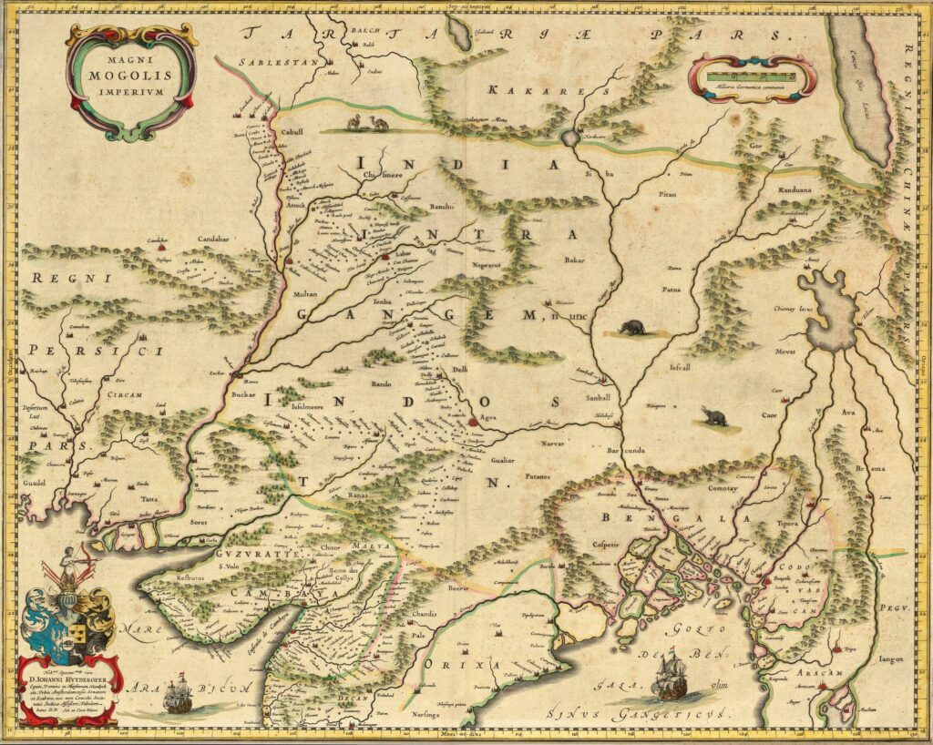
Magini Mogolis Imperium (Great Mughal Government), 1640, Willem/Joan Janszoon Blaeu, © Sarmaya Arts Foundation. (2021.12.5)
If you flip through the pages of Dr Manosi Lahiri’s Mapping India, you’ll see the roughly diamond-shaped contours of modern India take shape before your very eyes. The earliest surviving iteration of this form dates to the 16th Century. These early European maps feature the vast Mughal empire veined with rivers and dotted with some important cities, but largely composed of enigmatic blank spaces. How, when, by whom and through what means were these blank spaces eventually filled in? These are some of questions that Mapping India attempts to answer.
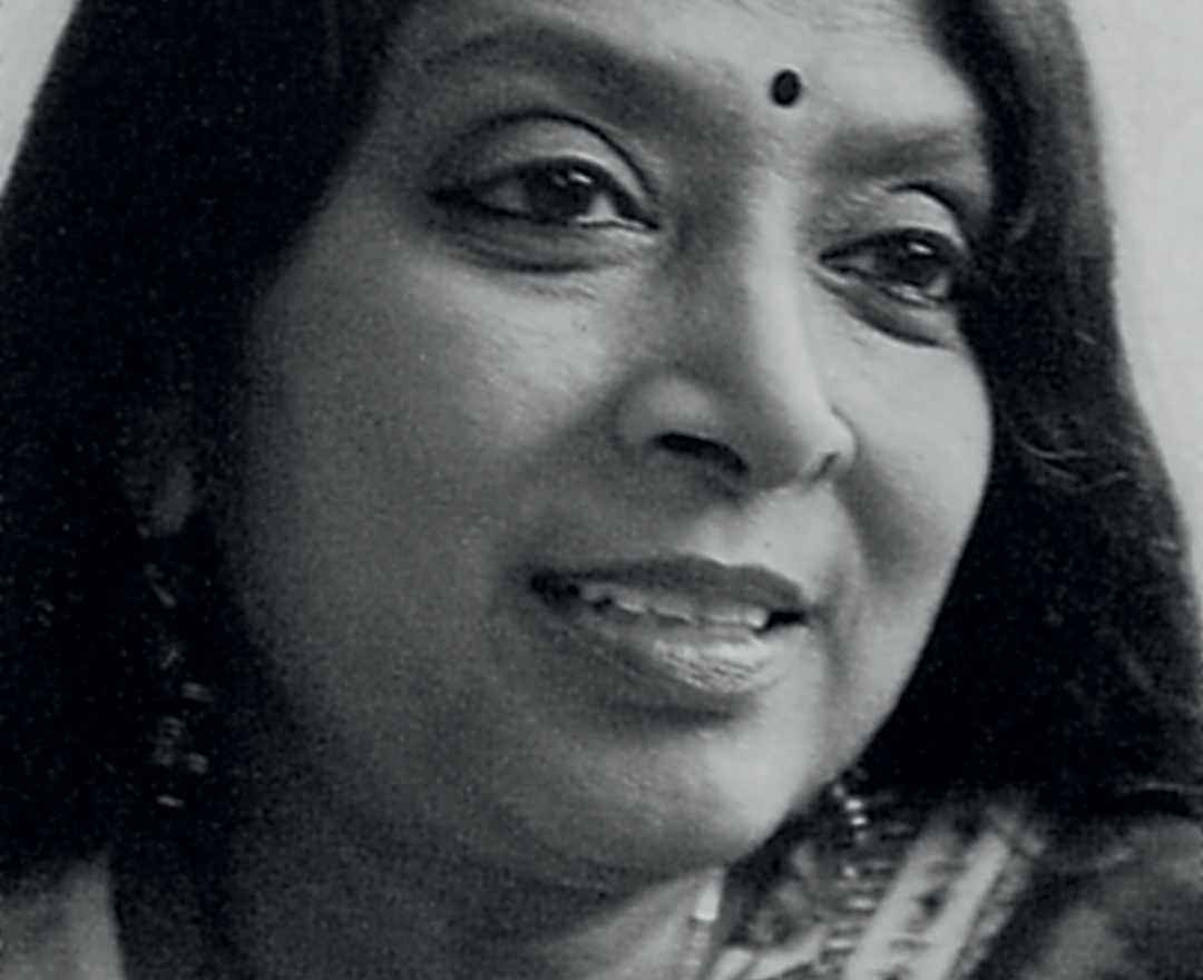
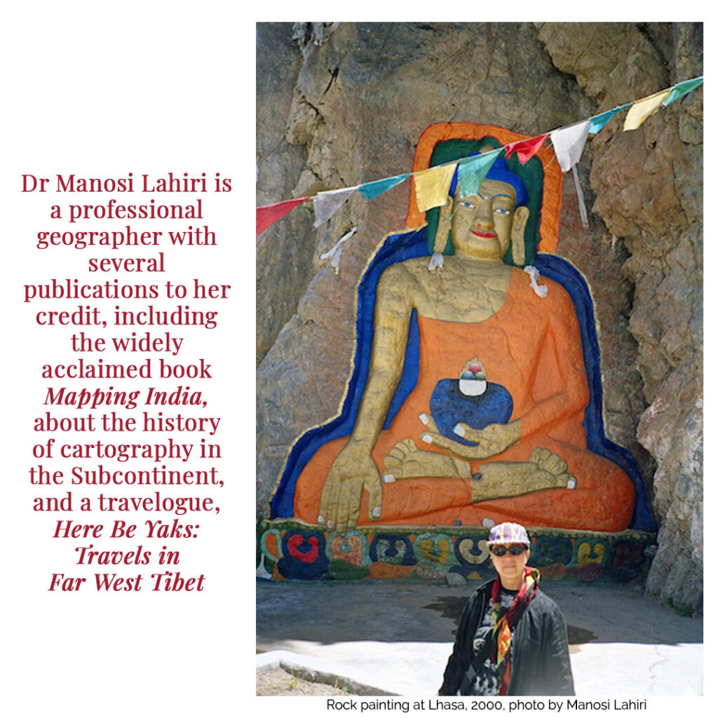
Its author is a map wizard by profession. Dr Lahiri is the founder of India’s first GIS (Geographic Information System) company, ML Infomap, and her contributions to the field were recognised by a Lifetime Achievement Award from Geospatial Media and Communications in 2010. While her work involves developing geo-solutions for enterprises, and creating digital maps for universities and research institutions, her interest in historical cartography gives her a unique vantage point from which to interpret India’s past.
Besides the highly acclaimed Mapping India, Dr Lahiri has also written a travelogue, Here Be Yaks: Travels in Far West Tibet. For Sarmaya’s Spotlight Open Roads, we spoke with her about the contribution made by travellers to the science and art of cartography. As she notes in Mapping India, “war and commerce were the main drivers of map-making in India”. But wanderlust also played a part in filling some of the blank spaces in those early maps. Dr Lahiri explains how.
Your book Mapping India is an eye-opening work that narrates the history of the subcontinent through an aerial view. Lines on old maps come to life as the reader absorbs the larger historical context of each such document. How did your own interest in geography begin?
“A map is a tool for a geographer and an instrument that encapsulates information in space and time. The seeds of interest in maps were sown while I was training as a geographer. I have been an avid user and creator of maps for several decades. What is particularly interesting about maps for me is that they represent imagined or actual events and places. And some old maps are beautifully crafted to tell stories, though present-day maps are more utilitarian.”
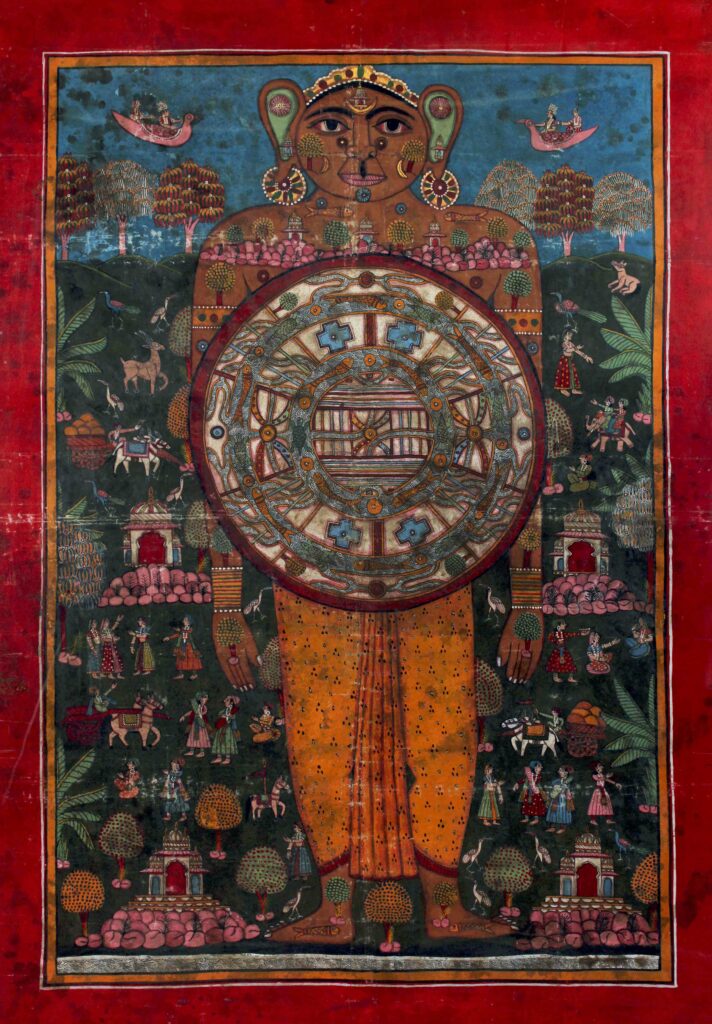
Lokapurusha, Jain cosmogram, tempera on cloth © Sarmaya Arts Foundation
Mapping India begins with an overview of early cartography, starting with the cosmographs of ancient India, which were based on mythology and often centred around pilgrimage sites. These were less navigational tools and more sacred souvenirs. How, then, did the people of that time navigate the land?
“Cosmographs record what was believed to be the world on the strength of myths, which could be very far off from what the facts are actually on the ground. So naturally they cannot be used for navigation, and they never were. People travelled in the old days for pilgrimage, visiting family, buying and selling goods… Armies covered great distances. They navigated by the stars and along known routes. They asked for directions along the way.”
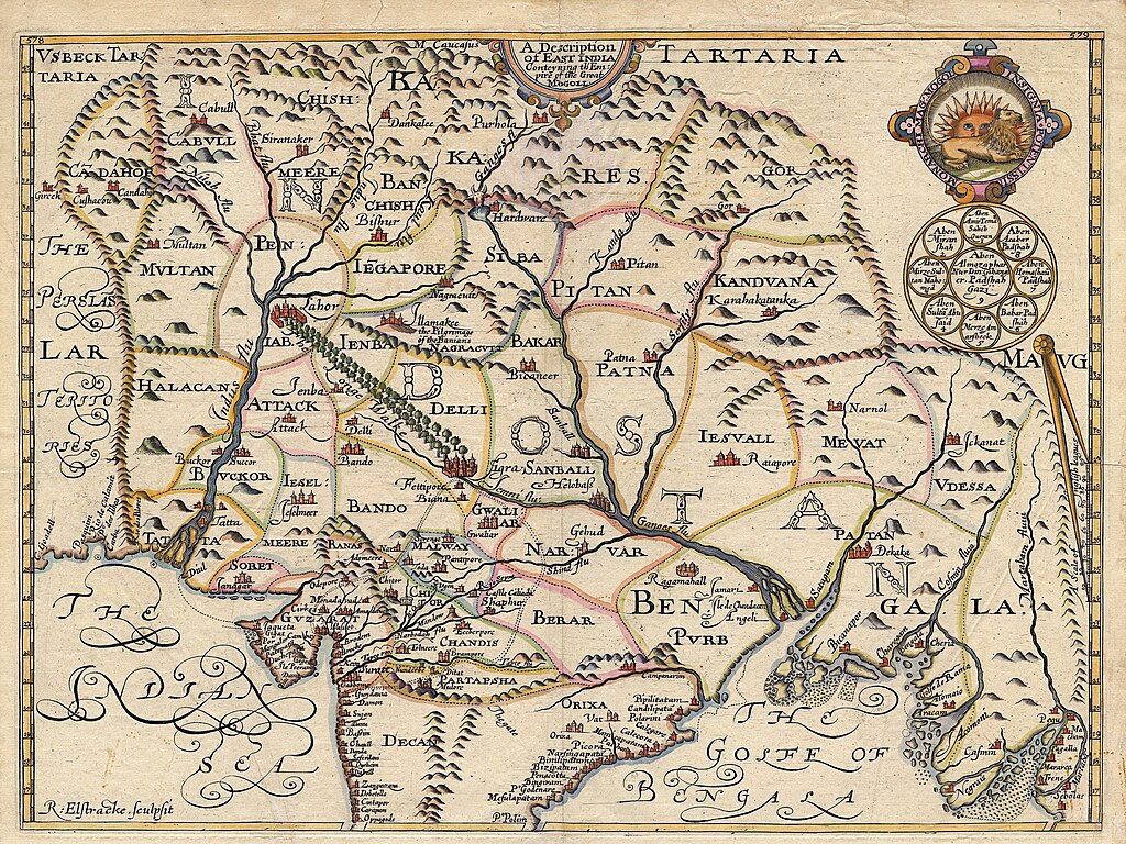
Map of Northern India by William Baffin, ca.1625, Public domain, via Wikimedia Commons
Some of the earliest maps presented in Mapping India were made by European traders and colonial entities. Could you give us a sense of how influential travelogues and what you refer to as “travellers’ yarn” were shaping these early maps?
“They were certainly influential because there was no other way of knowing about unknown lands, except from those who had been there. [William] Baffin’s map of India was the result of Thomas Roe’s accounts of his travels with Emperor Jehangir’s army in India. It is a very interesting map showing the outline of the country, the routes the armies marched on… including the route from Lahore to Agra, which he calls the `The Longe Walke’. The symbolic Gomukh, shown as a cow’s head at Haridwar, indicates that he was aware of the known source of the Ganges being somewhere there. At times, just a mention in a travel memoir can help in dating an old map. Like the map of Surat in the City Palace Museum in Jaipur can be dated by referring to [Niccolao] Manucci’s comment on the existence of city walls when he visited it.”
As you’ve written in your book, “The earliest maps were a magical blend of fact and imagination, of impressions culled from chronicles published by travellers and some expectation of what a foreign land could be like.” Could you give us some examples of how these feats of imagination manifested in maps?
“Over the centuries, our expectations have increased that maps should be perfect representations of reality. But in early times, before surveyed maps became the norm, features were included into maps based on hearsay too. Like the phantom lake, Chiamay Lacus, in Abraham Ortelius’ map of Asia. It perpetuated the myth of the lake being the source of large south-flowing rivers in Indochina. Similarly, the belief that the rivers Ganga, Sutlej, Tsangpo and Karnali flowed out of Lake Manasarovar was widespread and repeated in maps till the 19th Century.”
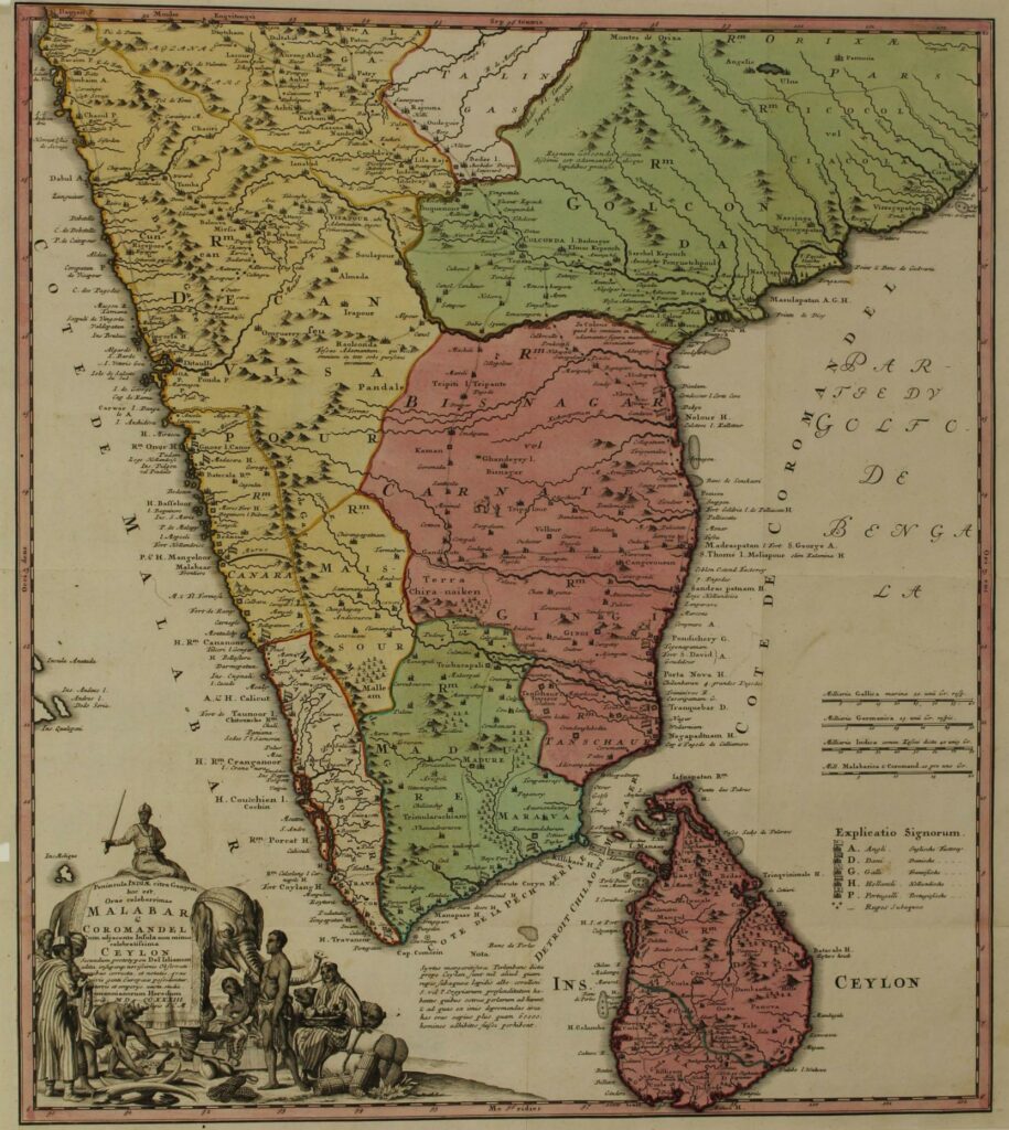
Map of the Coasts of Malabar, Coromandel and Ceylon (now Sri Lanka), 1733 © Sarmaya Arts Foundation
Many early maps of India are visually stunning with intricate cartouches and a definite artistic flair in the filling of blank spaces with details that evoke an ‘exotic East’. Were maps ever envisioned as tools to advertise the allure of India to enterprising European travellers or traders?
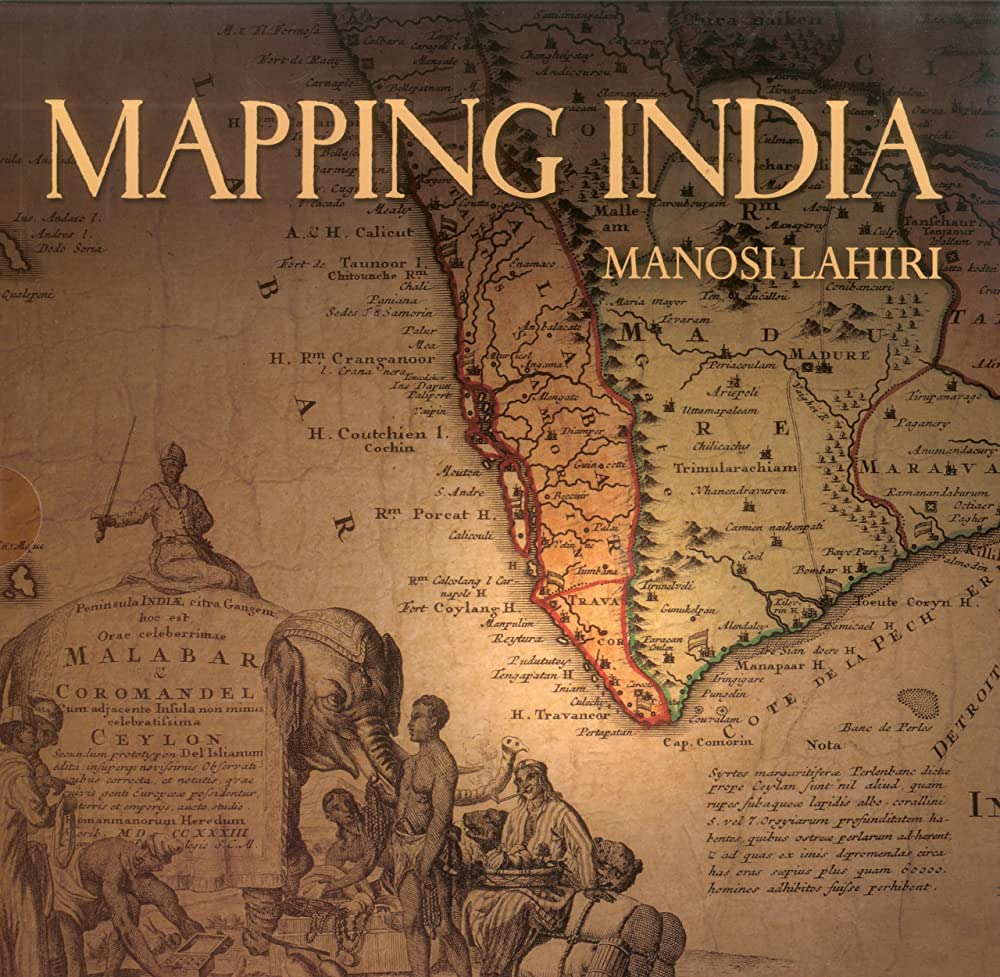
“That’s an interesting question! I am not sure the purpose was to encourage travels to the East, but certainly commerce would be an important consideration. After all, East India Companies from so many European nations came to trade here. The cartouches in Rennell’s Map of Hindoostan and Homann Heirs’ map of Malabar and Coromandel show products sourced from India. I have used the cartouche from the latter as a cover image for my book Mapping India.”
Travelogues were another source of information for cartographers. Which ones were referenced for India by the map-makers of the 17th and 18th centuries?
“There are many accounts of journeys of Portuguese and French travellers of that period in Mughal India, some of which also included maps. I recollect coming across published works of Niccolao Manucci,van Linschoten, Francois Bernier, Joao de Barros, Tavernier and many more. There are records of Father Monserrate’s astounding feat of crossing the Mana pass to reach the Guge kingdom near today’s Toling. Jean Baptiste-Joseph Gentil’s fabulous atlas, illustrated with maps, local animals and people’s customs, is outstanding.”
In the 19th Century, travel became a covert way for imperial governments to gather information on uncharted lands. You write about how Alexander Burnes’s travelogue Travels to Bokhara helped the British survey the route along the Indus river. Please could you elaborate on this trend of clandestine travel surveys.
“As the British were expanding their territories in India, they sent out spies to gather information in the borderlands and neighbouring kingdoms, where they were obviously not welcome. So they trained surveyors to travel incognito and collect information. Peter Hopkirk’s book Trespassers on the Roof of the World has a great account of the Pandits’ travels in Tibet. Sarat Chandra Das published Lhasa and Central Tibet, an account of his stay and clandestine survey in Tibet. And I am sure there were many others whose journeys went unrecorded.”
Mapping India brings out so many incredible stories about unsung Indians who contributed to the understanding of remote geographies on the Subcontinent. Please could you elaborate on a few such instances or individuals.
“You are referring to the time we were a colony… this is expected of those times. But I am glad there is documentation about the roles of Nain Singh and other Pundits, Sarat Chandra Das, Radhanath Sickdhar (Sikdar) and a few others. In my view, the one who deserved much greater recognition was Sickdhar, both for his contribution to the Manual of Survey and for calculating the height of Peak XV, which was later named Mount Everest. He showed that Peak XV was the highest on earth through GTS measurements, at a time when it could not be explored and mapped.”
As a geographer, how has your practice and scholarship been informed by the act of travelling? Have you had moments of insight while on the road?
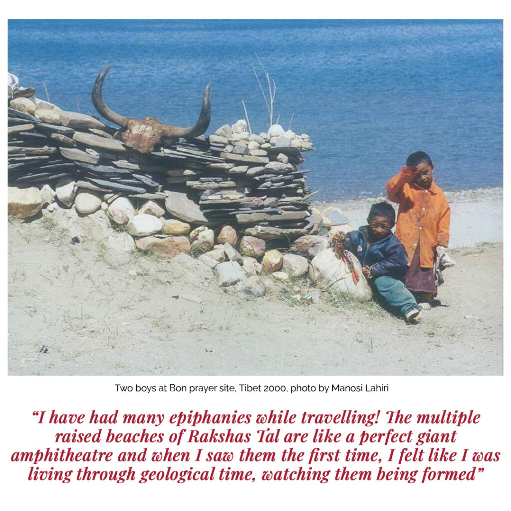
“Indeed, I have had many epiphanies while travelling! The multiple raised beaches of Rakshas Tal are like a perfect giant amphitheatre and when I saw them the first time, I felt like I was living through geological time, watching them being formed! I have experienced the most stunning moments of revelation when we drove through the expanses of Tibet and ‘saw’ void spaces.”
You have also written about geography in a more intimate way, as a traveller in Here Be Yaks – A Personal Account of Travels In Far West Tibet. What inspired that journey?
“I had read Swami Pranavananda’s Kailas-Manasarovar, which enthused me to make the journey, though not as a pilgrim. My interest was in topography and geology. Looking back, I’d say it was also partly to make a break from routine, to venture into the unknown with a group of wonderful companions. We were immersed in the most stupendous landscapes in the world and realised what isolation meant. The experience was powerful.”
Do you have any upcoming projects—books, lecture series, etc—that you’d like us to share with our readers?
“Recently, I gave a public talk at the Asiatic Society of Mumbai. I was so delighted that the audience were invested in the topic: Mapping India, Then and Now. I focussed on informing how technological changes had impacted the mapping of the subcontinent. I was pleasantly surprised that so many queries came up at the end of the talk.
“Also, I have written for the History of Cartography series on the topographic and railway mapping of South Asia. This series is published by the University of Chicago Press and Vol. V, in which my articles will appear, is awaiting publication.”

