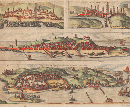

View of Anfa, Azamor, Diu and Goa from Civitates Orbis Terrarum
In the early history of map-making, the representation of cities was mostly done as sketches that were part of book illustrations or primarily bird’s-eye views. This composite view is part of Georg Braun and Frans Hogenberg’s, the Civitates Orbis Terrarum. The first volume of this landmark atlas was published in 1572, and its final volume… Read more »

