Dutch

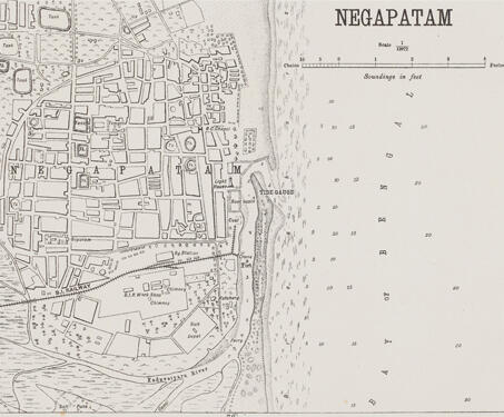
Negapatam

This detailed map of Nagapattinam (previously spelt, Negapatam) was created by the Office of the Trigonometric Branch, Survey of India, Dehra Dun. The map gives a complete overview of the city, highlighting its water tanks, churches, and temples. Owing to the enormous endeavours of the Survey of India, precision in documenting became more important as mapping… Read more »

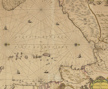
Gulf of Ganges, Gulf of Bengal, and New Descriptions

This map, made by Johannes Janssonius (1588-1664), a Dutch cartographer, illustrates the Bay of Bengal in detail and is one of the oldest sea maps. While it may appear disorienting, the inclusion of ‘Orixa’ and ‘Ceylon’ aid in establishing orientation, with Ceylon to the left of the map representing the south. The Dutch East India… Read more »

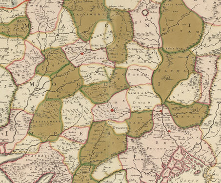
Magni Mogolis Imperivm (Great Mogolis Government)

The Dutch cartographer Frederik de Wit produced this map titled ‘Magni Mogolis Imperivm de Novo Correctum et Divisum Per’ in the early 18th century. Maps began to play an increasingly important role in realising European nationalist and imperialist ambitions, both practically and ideologically. This map shows the extent of the Mughal Empire in the early… Read more »

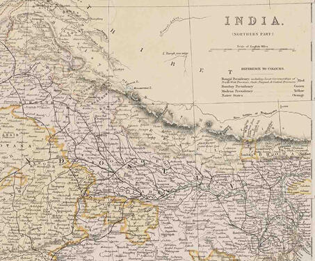
India (Northern Part)

This map titled ‘India (northern Part)’ highlights the northern divisions of territory into presidencies and native states. The Bengal Presidency is marked in red including the lieutenant-governorships of the North-West provinces, Oudh, Punjab and Central Provinces; Bombay Presidency is marked in green, Madras in Yellow and native states in orange. After significant territorial acquisitions were… Read more »

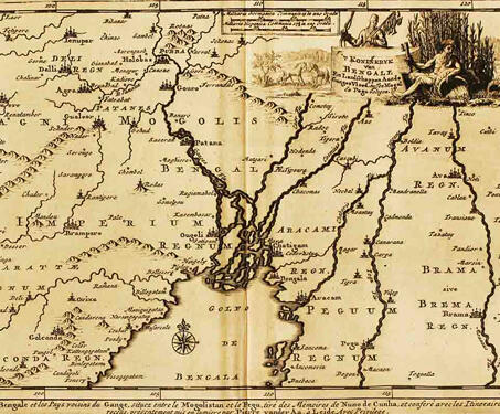
Koninkryk van Bengale (Kingdom of Bengal)

This map by Dutch publisher Pieter van der Aa is from his book, Royaumma de Grand Mogol, published in Paris in 1729. It is based on William Baffin’s map, ‘INDOISTANI A Description of East India, conteyninge th’ Empire of The Great Mogoll,’ that was published in 1619. Baffin’s map was the first modern map of… Read more »