
Negapatam
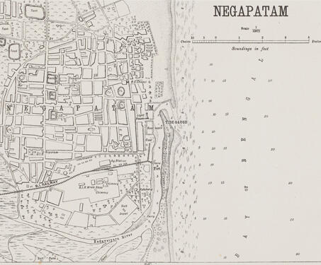
This detailed map of Nagapattinam (previously spelt, Negapatam) was created by the Office of the Trigonometric Branch, Survey of India, Dehra Dun. The map gives a complete overview of the city, highlighting its water tanks, churches, and temples. Owing to the enormous endeavours of the Survey of India, precision in documenting became more important as mapping… Read more »


