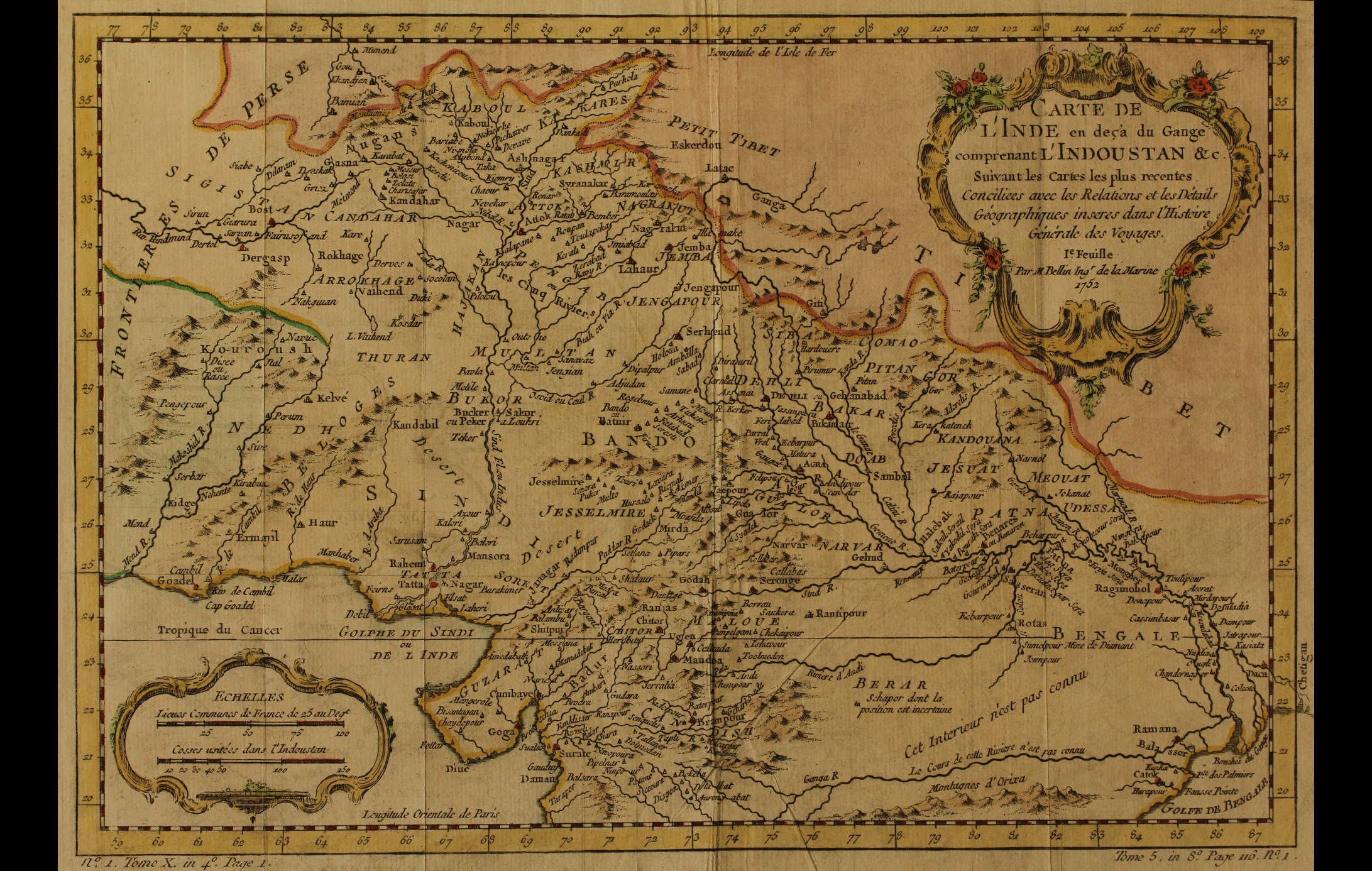
This map titled ‘Carte De L’Inde En Deca Du Gange Comprenant L’Indoustan &C.’, produced by a French cartographer Jacques Nicolas Bellin (1703-1773) was published in Petit Atlas Maritime, a part of a five-volume atlas published by him.
It illustrates Northern region of the subcontinent of modern-day India, Afghanistan and Pakistan. By the late eighteenth century, the systematic surveying, recording and compiling of the Indian subcontinent by the Europeans had commenced. The Gangetic delta was an important region to be mapped to help the mariners navigate safely and establish routes towards major seaports and trade centres.
To read more, click here.
Title
Carte De L'Inde en deca du Gange comprenant L'indoustan & c.(Map of India below the Ganges including Hindustan)Period
1764Cartographer
Jacques Nicolas Bellin Carte De L'Inde en deca du Gange comprenant L'indoustan & c.(Map of India below the Ganges including Hindustan)Medium
H:24.4 cm x W: 35.5 cmAccession No.
2015.4.5Genre: Cartography