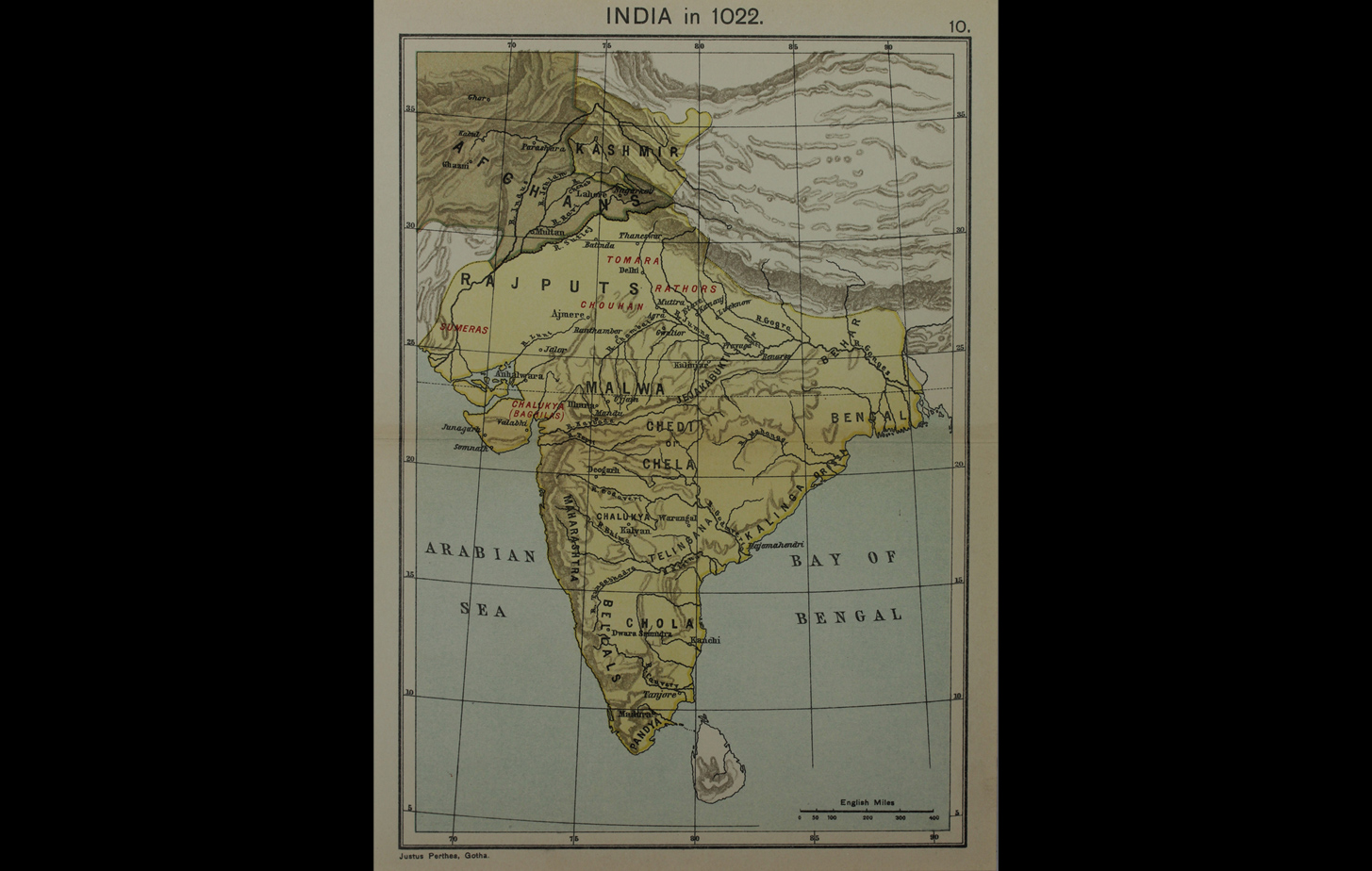
This map depicts geographical features and the distribution of various Hindu dynasties in India in 1022. In the north-west, the Ghaznavid Empire was at its zenith under Sultan Mahmud of Ghazni (971 – 1030), who crossed the river Indus and plundered India seventeen times during the course of his reign.
The map was published in a 1914 atlas by the German firm Justhus Perthes; renowned for its work in cartographic publishing since the early 19th century, the firm is considered one of the pioneers of the hand atlas.
Title
Map of India in 1022Period
1914Publisher
Justhus Perthes, GothaMedium
Polychrome Engraving on PaperDimensions
H: 26.8 cm x W: 23.5 cmAccession No.
2015.4.35Genre: Cartography