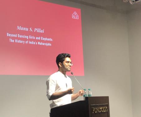

‘India’s Maharajas, Beyond Dancing Girls & Elephants’ by Manu S Pillai
Drawn from his book, ‘False Allies’, historian and author Manu S Pillai draws an intriguing portrait of the rulers of India’s princely states as we have rarely seen them before.

Drawn from his book, ‘False Allies’, historian and author Manu S Pillai draws an intriguing portrait of the rulers of India’s princely states as we have rarely seen them before.
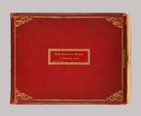
The Delhi Durbar of 1903 was conceived by Lord Curzon to celebrate the succession of Edward VII and Alexandra of Denmark as Emperor and Empress of India. On 24 January 1901, two days after the death of Queen Victoria, King Edward VII was proclaimed the Emperor of India. King Edward, for many ruling heads of… Read more »
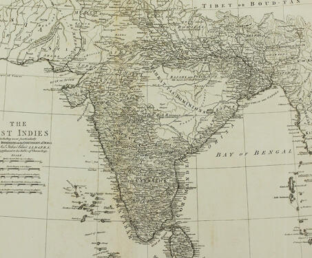
This historic paper map entitled ‘The East Indies including more particularly the British Dominions on the Continent of India’, by John Blair ; T. Kitchin, senr. sculpsit., was published by in 1773. It covers India, Sri Lanka, Bangladesh, Bhutan, Nepal, and portions of Maldives, Iran, Afghanistan, Pakistan, China, Burma, and Indonesia. The map shows features… Read more »
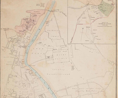
Edward Weller’s engraving is part of a series of maps from around the world published in the British Weekly Dispatch newspaper. The city of Lucknow is remembered as the site of prolonged siege during the 1857 Sepoy Rebellion. Weller’s engraving emphasises the dividing lines within the recently acquired settlement, highlighting the separation of the British… Read more »
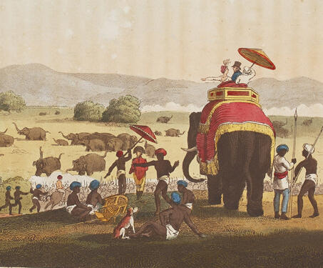
“Oriental Field Sports being a complete, detailed, and accurate VISUAL DESCRIPTION of the wild sports of the East and exhibiting, in a novel and interesting manner, the natural history of the elephant, the rhinoceros, the tiger … and other undomesticated animal…“, as the long title suggests, is a rare book accounting detailed descriptions of the… Read more »
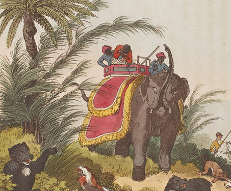
“Oriental Field Sports being a complete, detailed, and accurate VISUAL DESCRIPTION of the wild sports of the East and exhibiting, in a novel and interesting manner, the natural history of the elephant, the rhinoceros, the tiger … and other undomesticated animal…“, as the long title suggests, is a rare book accounting detailed descriptions of the… Read more »
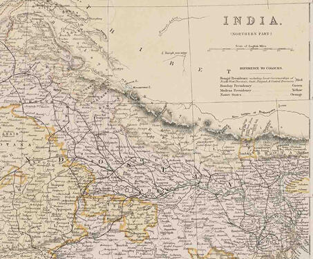
This map titled ‘India (northern Part)’ highlights the northern divisions of territory into presidencies and native states. The Bengal Presidency is marked in red including the lieutenant-governorships of the North-West provinces, Oudh, Punjab and Central Provinces; Bombay Presidency is marked in green, Madras in Yellow and native states in orange. After significant territorial acquisitions were… Read more »
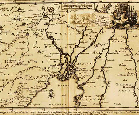
This map by Dutch publisher Pieter van der Aa is from his book, Royaumma de Grand Mogol, published in Paris in 1729. It is based on William Baffin’s map, ‘INDOISTANI A Description of East India, conteyninge th’ Empire of The Great Mogoll,’ that was published in 1619. Baffin’s map was the first modern map of… Read more »
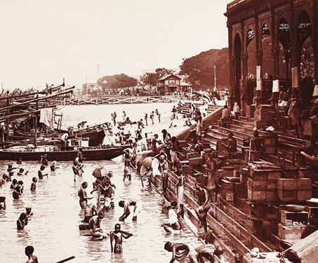
This image shows the Armenian Ghat by the Hooghly River. It is said to have been built in 1734 by Manvel Hazaar Maliyan, an Armenian Trade merchant. The Armenians came to Bengal in the 16th century CE, during the Mughal rule, for commercial purposes and established a settlement much before the British East India Company… Read more »
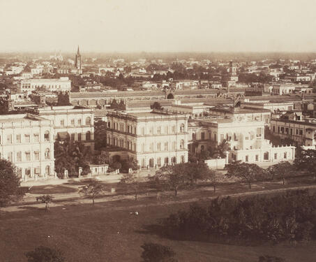
This view looks east from across the Maidan and the Chowringhee road with a clear landscape of the public buildings and private houses. Chowringhee Road was one of the Maidan’s major streets, and one of Calcutta’s broadest avenues. It was almost two miles in length and about eighty feet in width, with houses on one… Read more »
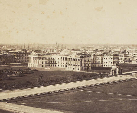
This view looks north-west from the Ochterlony Monument across the maidan towards the Government House and building along the Esplanade row. The image also captures other important buildings partly visible in the background, such as the General Post Office, the Writers’ Building, and St. John’s Church. In the 1760s, the establishing years of the East… Read more »
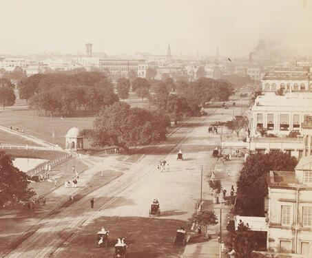
This picture shows the north side of the vast open space, known as the Maidan, in the centre of Calcutta, bordered by Chowringhee Road. The Maidan is surrounded by the city’s main public buildings, such as the Government House, on the far left behind the Ochterlony Monument, now called the Shahid Minar. Open spaces were… Read more »
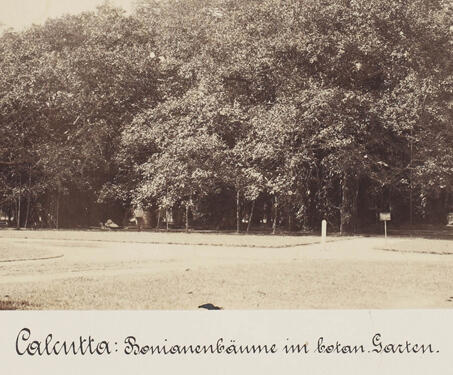
This picture shows a view of the famous vast-spreading Banyan tree at the Botanical Garden, situated on the west bank of the Hooghly river in Calcutta. The garden was established in 1787 as “Company Bagan” by Colonel Robert Kyd, a horticulture enthusiast, who worked as the secretary of the Military Board at Fort William. Botanist… Read more »
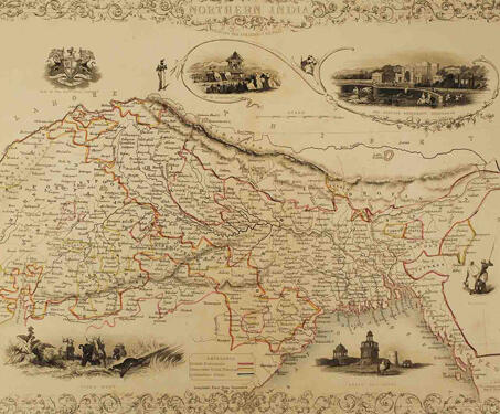
This is a decorative, mid-19th century map of Northern India drawn and engraved by J. Rapkin (vignettes by A. H. Wray & J. H. Kernot) and published in John Tallis’s Illustrated Atlas (London & New York: John Tallis & co, c.1851). The Illustrated Atlas, published from 1849 to 1853, was the last decorative world atlas.… Read more »

This map, Carte Du Bengale, is attributed to Arkstée & Merkus, but it is based on a map by French geographer Loui Brion de la Tour, who also made the Atlas Géneral, Civil et Ecclésiastique’, 1766, and ‘Atlas Général’, 1790-98. The eighteenth century was a time of conflict between the English and French in both… Read more »
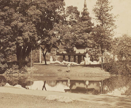
This picture shows a view of Kolkata’s Eden gardens with a pagoda in the background and a bridge over a stream. Overlooking the Hooghly River, Eden Gardens was formally opened to the public in 1840. It was Lord Auckland, the Governor-General (1836-42), and his sisters who conceived the idea of the gardens and assigned the… Read more »

This photo shows a view of the Bandstand and the Burmese Pagoda in Eden Gardens from across Strand Road in Kolkata. It was Lord Auckland, the Governor-General (1836-42), and his sisters who conceived the idea of Eden Gardens around the northern periphery of Fort William and assigned the responsibility of planning it to Civil Architect… Read more »