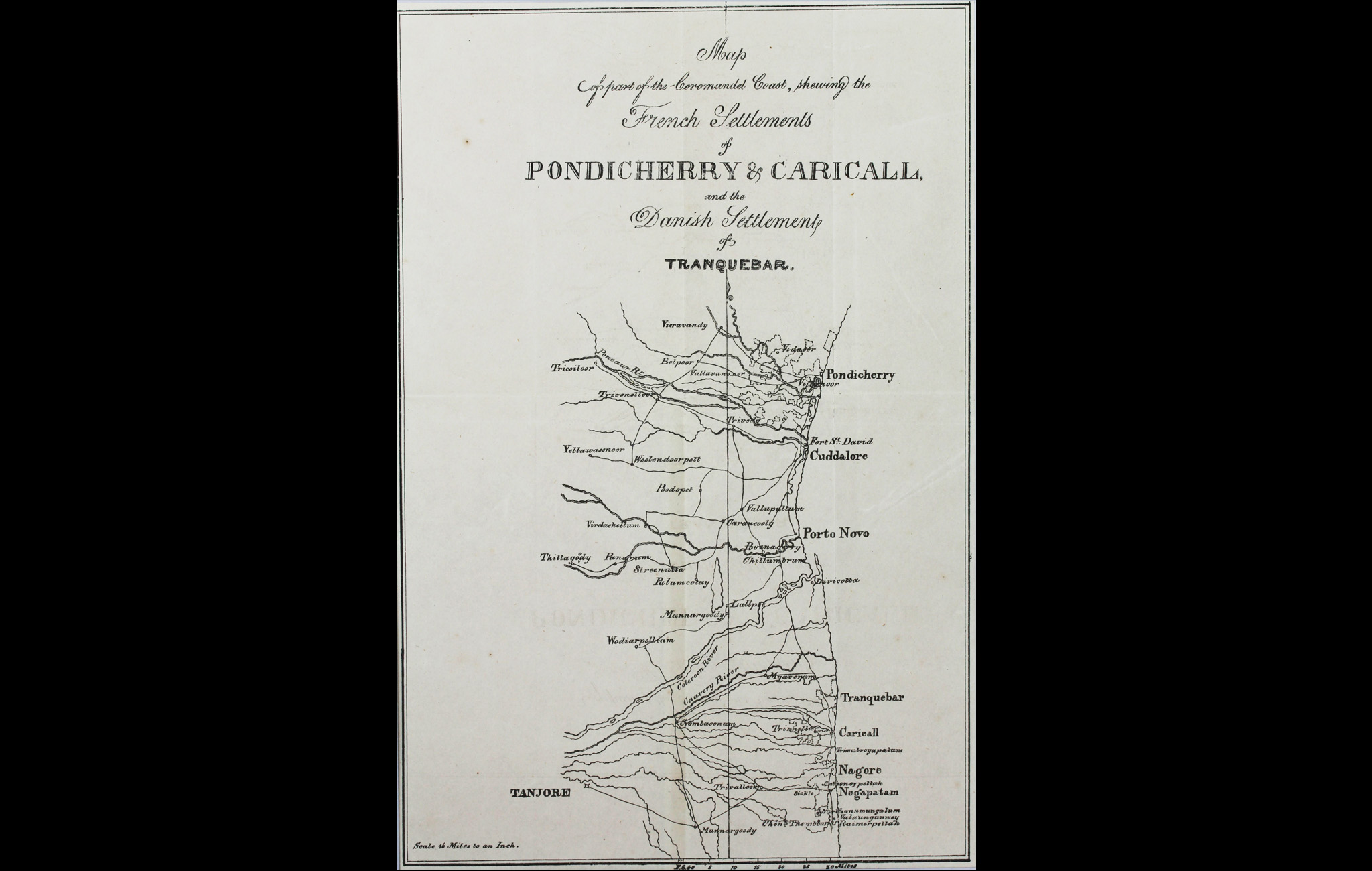
This topographical map of a part of the Coromandel Coast depicts Pondicherry and its surrounding territories. Tranquebar was a small town on the Carnatic Coast. Fort Dansborg at Tranquebar was established by the Danes in 1620 and sold to the British in 1845. The Danish East India Company lost out to the British, who cornered their trade. By 1869, the Danes had sold all their property in India.
On the other hand, nearby Pondicherry remained the cornerstone of all French activities in India until 1954. It was founded by the French agent in the Carnatic, Francois Martin, in 1674 on land purchased from the Sultan of Bijapur. However, they only built the first fortification around the city after the Dutch attacked in 1693 from the sea and occupied Pondicherry. The Dutch did not remain in Pondicherry for long and the French regained control. However, the French lost the city to the British after the battle of Wandewash (Vandavasi) in 1760.
Title
Map of part of the Coromandel Coast, Showing the French Settlements of Pondicherry and Caricall and the Danish Settlement of TranquebarPeriod
1841Medium
Print on paperDimensions
H: 26.4 cm x W: 17.7 cmAccession No.
2015.4.23Genre: Cartography